|
|

Map of Armenia by Philip de la Rue, printed in 1653
|
Map of Armenia by Philip de la Rue, printed in 1653
 Click on image to enlarge Click on image to enlarge
|

Turkey in Asia, 1729
|
Turkey in Asia, 1729
 Click on image to enlarge Click on image to enlarge
|

Tabula Nova Asie Minoris
|
Tabula Nova Asie Minoris
 Click on image to enlarge Click on image to enlarge
|

World map from Ptolemy, Geographia. Freiburg: Joannes Schott, 1503, (Fragment)
|
World map from Ptolemy, Geographia. Freiburg: Joannes Schott, 1503, (Fragment)
 Click on image to enlarge Click on image to enlarge
|

Countries depicted by St Paul during his pilgrimages, 1595
|
Countries depicted by St Paul during his pilgrimages, 1595
 Click on image to enlarge Click on image to enlarge
|

World map from Ptolemy, Geographia. Freiburg: Joannes Schott, 1503, (Fragment)
|
World map from Ptolemy, Geographia. Freiburg: Joannes Schott, 1503, (Fragment)
 Click on image to enlarge Click on image to enlarge
|

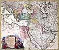
Turkish Empire, 1748
|
Turkish Empire, 1748
 Click on image to enlarge Click on image to enlarge
|

Mount Ararat
|
Mount Ararat
 Click on image to enlarge Click on image to enlarge
|

Tabula Asiae III (Black & Capian Sea Region), 1552, Basle
|
Tabula Asiae III (Black & Capian Sea Region), 1552, Basle
 Click on image to enlarge Click on image to enlarge
|

Mount Ararat
|
Mount Ararat
 Click on image to enlarge Click on image to enlarge
|
|
|

