|
|

Map of Armenia, 1718
|
Map of Armenia, 1718
 Click on image to enlarge Click on image to enlarge
|

Armenia, Syria, Mesopotamia, 1683
|
Armenia, Syria, Mesopotamia, 1683
 Click on image to enlarge Click on image to enlarge
|

Map of Armenia by Philip de la Rue, printed in 1653
|
Map of Armenia by Philip de la Rue, printed in 1653
 Click on image to enlarge Click on image to enlarge
|

Reconstruction of the world map according to Dionysius (124 A.D.)
|
Reconstruction of the world map according to Dionysius (124 A.D.)
 Click on image to enlarge Click on image to enlarge
|

A General Map for Information about the History of the Saints, 1783
|
A General Map for Information about the History of the Saints, 1783
 Click on image to enlarge Click on image to enlarge
|

Mount Ararat
|
Mount Ararat
 Click on image to enlarge Click on image to enlarge
|

Map of Armenia, 1718
|
Map of Armenia, 1718
 Click on image to enlarge Click on image to enlarge
|

A General Map for Information about the History of the Saints, 1783
|
A General Map for Information about the History of the Saints, 1783
 Click on image to enlarge Click on image to enlarge
|

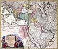
Turkish Empire, 1748
|
Turkish Empire, 1748
 Click on image to enlarge Click on image to enlarge
|

Turkish Empire, 1748
|
Turkish Empire, 1748
 Click on image to enlarge Click on image to enlarge
|
|
|

