|
|

A General Map for Information about the History of the Saints, 1783
|
A General Map for Information about the History of the Saints, 1783
 Click on image to enlarge Click on image to enlarge
|

World map from Ptolemy, Geographia, edited by Lorenz Fries. Strassburg: J. Grueninger, 1522, (Fragment)
|
World map from Ptolemy, Geographia, edited by Lorenz Fries. Strassburg: J. Grueninger, 1522, (Fragment)
 Click on image to enlarge Click on image to enlarge
|

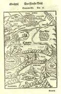
Sarmatia Asie, 1579, Basle
|
Sarmatia Asie, 1579, Basle
 Click on image to enlarge Click on image to enlarge
|

Turkey in Asia, 1729
|
Turkey in Asia, 1729
 Click on image to enlarge Click on image to enlarge
|

Asia Minor from Ptolemy's Geography, 1513
|
Asia Minor from Ptolemy's Geography, 1513
 Click on image to enlarge Click on image to enlarge
|

Map of Armenia by Philip de la Rue, printed in 1653
|
Map of Armenia by Philip de la Rue, printed in 1653
 Click on image to enlarge Click on image to enlarge
|

Armenia, Syria, Mesopotamia, 1683
|
Armenia, Syria, Mesopotamia, 1683
 Click on image to enlarge Click on image to enlarge
|

Reconstruction of Hecataeus' map of the habitable world
|
Reconstruction of Hecataeus' map of the habitable world
 Click on image to enlarge Click on image to enlarge
|

Sarmatia Asie, 1579, Basle
|
Sarmatia Asie, 1579, Basle
 Click on image to enlarge Click on image to enlarge
|

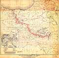
President Woodrow Wilson's map for Armenia, 1920
|
President Woodrow Wilson's map for Armenia, 1920
 Click on image to enlarge Click on image to enlarge
|
|
|

