|
|

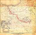
President Woodrow Wilson's map for Armenia, 1920
|
President Woodrow Wilson's map for Armenia, 1920
 Click on image to enlarge Click on image to enlarge
|

Asia Minor, Armenia, Circassia and Syria, 1812
|
Asia Minor, Armenia, Circassia and Syria, 1812
 Click on image to enlarge Click on image to enlarge
|

A General Map for Information about the History of the Saints, 1783
|
A General Map for Information about the History of the Saints, 1783
 Click on image to enlarge Click on image to enlarge
|

Armenia Major, Iberia, Colchis and Albania
|
Armenia Major, Iberia, Colchis and Albania
 Click on image to enlarge Click on image to enlarge
|

Mount Ararat
|
Mount Ararat
 Click on image to enlarge Click on image to enlarge
|

Map of Asiatic part of Turkey
|
Map of Asiatic part of Turkey
 Click on image to enlarge Click on image to enlarge
|

World map according to Posidonius (150-130 B.C.)
|
World map according to Posidonius (150-130 B.C.)
 Click on image to enlarge Click on image to enlarge
|

Mount Ararat
|
Mount Ararat
 Click on image to enlarge Click on image to enlarge
|

Map of Asiatic part of Turkey
|
Map of Asiatic part of Turkey
 Click on image to enlarge Click on image to enlarge
|

President Woodrow Wilson's map for Armenia, 1920
|
President Woodrow Wilson's map for Armenia, 1920
 Click on image to enlarge Click on image to enlarge
|
|
|

