|
|

Tabula I Asiae
|
Tabula I Asiae
 Click on image to enlarge Click on image to enlarge
|

Countries depicted by St Paul during his pilgrimages, 1595
|
Countries depicted by St Paul during his pilgrimages, 1595
 Click on image to enlarge Click on image to enlarge
|

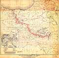
President Woodrow Wilson's map for Armenia, 1920
|
President Woodrow Wilson's map for Armenia, 1920
 Click on image to enlarge Click on image to enlarge
|

World map from Ptolemy, Geographia. Freiburg: Joannes Schott, 1503
|
World map from Ptolemy, Geographia. Freiburg: Joannes Schott, 1503
 Click on image to enlarge Click on image to enlarge
|

Armenia, Georgia, and Daghistan, 1720, Paris
|
Armenia, Georgia, and Daghistan, 1720, Paris
 Click on image to enlarge Click on image to enlarge
|

Mount Ararat
|
Mount Ararat
 Click on image to enlarge Click on image to enlarge
|

Map of the Old and New Armenia, 1751
|
Map of the Old and New Armenia, 1751
 Click on image to enlarge Click on image to enlarge
|

Tabula Nova Asie Minoris
|
Tabula Nova Asie Minoris
 Click on image to enlarge Click on image to enlarge
|

Map of the Area of the Caspian Sea, 1730
|
Map of the Area of the Caspian Sea, 1730
 Click on image to enlarge Click on image to enlarge
|

Map of the Area of the Caspian Sea, 1730
|
Map of the Area of the Caspian Sea, 1730
 Click on image to enlarge Click on image to enlarge
|
|
|

